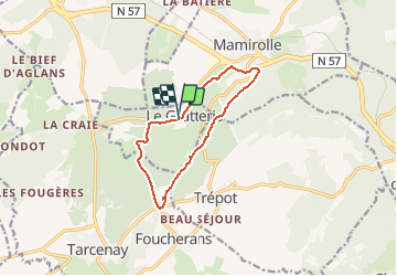
Trail Walking Le Gratteris - Le Gratteris - Photo
© OpenStreetMap contributors
Length
Length
10.1 km
Max alt
Max alt
635 m
Uphill gradient
Uphill gradient
236 m
Km-Effort
Km-Effort  
13.2 km
Min alt
Min alt
463 m
Downhill gradient
Downhill gradient
237 m
Boucle
Boucle
Yes
Creation date :
2020-10-24 11:24:31.656
Updated on :
2024-06-30 15:46:05.782

(0 Reviews)

Walking
Walking
4h36
Difficulty : Easy

Scan this QR Code to open this trail in the SityTrail application

FREE GPS app for hiking

Logo SityTrail SityTrail

IGN / Geographical institutes

Download SityTrail from the App Store Download SityTrail from Google Play

Logo SityTrail SityTrail Plus

The world is yours!

Download SityTrail from the App Store Download SityTrail from Google Play Download SityTrail on Huawei AppGallery

About

Trail Walking of 10.1 km to be discovered at Bourgogne-Franche-Comté, Doubs, Le Gratteris. This trail is proposed by eltonnermou.

Description

rando 1/2 pieds propres
randonnée sur le 1er plateau, à travers prairies et forêts qui à cette saison nous fait profiter de ses éclats de couleur. Un beau point de vue sur la plaine de Saône et autres villages.
Laissez vous surprendre par le passage d’un chevreuil.

Elevation profile

Photos

Positioning

Country:
France
Region :
Bourgogne-Franche-Comté
Department/Province :
Doubs
Municipality :
Le Gratteris
Location:
Unknown
Start:(UTM)
283195 ; 5229521 (32T) N.


Close
My subscriptions